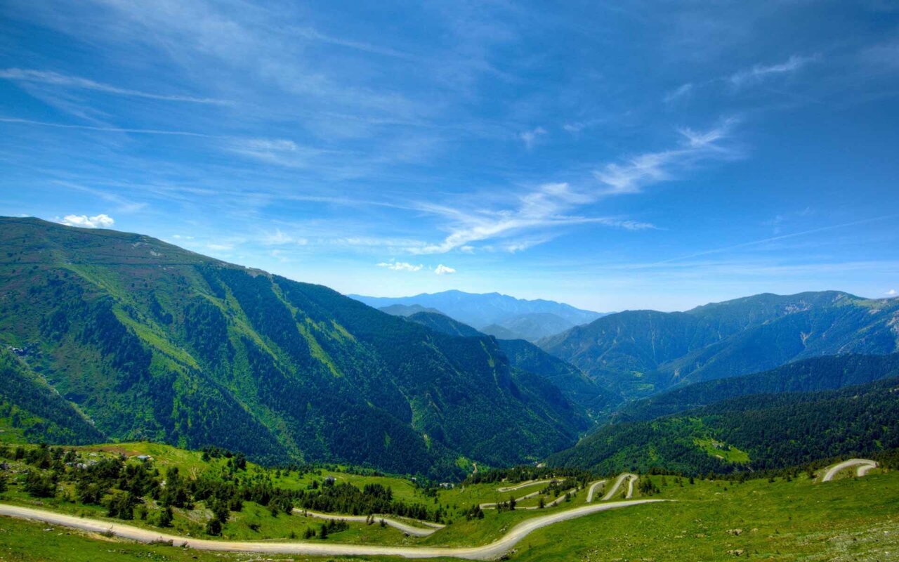
Does anyone know the location of the background picture? And is that paved or dirt road?
Navigation
Install the app
How to install the app on iOS
Follow along with the video below to see how to install our site as a web app on your home screen.
Note: This feature may not be available in some browsers.
More options
You are using an out of date browser. It may not display this or other websites correctly.
You should upgrade or use an alternative browser.
You should upgrade or use an alternative browser.
Background Picture
- Thread starter Bo Jo
- Start date
May require a little more info. RIDE SAFEDoes anyone know the location of the background picture? And is that paved or dirt road?
I believe the OP is referring to the back round picture on this site. It appears on the left and right margins. the road in question is on the bottom left and appears to be blacktop pavement with some very large mountains in the back round
- Admin
- #4
I think it is in the Swiss Alps but don't know the name of the area.
I was thinking Rockies above Estes Park.
Kinda resembles the Black Hills, but that's just a guess. Then again, it also looks like the road at the base of hill 151 in Bien Dien Province II Corp, but I kinda doubt it.
Phu Cat
Don't see any 105 holes so I doubt it also...
it's Maggie Valley, silly boys 
Does anyone know the location of the background picture? And is that paved or dirt road?
I don't know where it is, but here it is...

http://www.triketalk.com/forum/images/triketalk/misc/winding-road.jpg
Is that route 66?
Is that route 66?
more like route 666 :AGGHH::xzqxz:
- Admin
- #12
It looks a lot like this place:
Does anyone know the location of the background picture? And is that paved or dirt road?
It is paved road coming out of Aspen, CO
- - - Updated - - -
This is a paved road, coming out of Aspen, CO at Independence Pass
I thought that was where it was. RIDE SAFE
It is paved road coming out of Aspen, CO
- - - Updated - - -
This is a paved road, coming out of Aspen, CO at Independence Pass
can it be found on Google Satelitte Maps? If so can you give a little more info to find it?:wave4:
can it be found on Google Satelitte Maps? If so can you give a little more info to find it?:wave4:
I took this picture when we were riding from Aspen south toward Independence Pass. It's beautiful and excellent motorcycle road, but I couldn't tell you exactly on Satellite where it is. Sorry, I'm just the rider and picture-taker.
That looks like my view out of my back window here in Florida.
That looks like my view out of my back window here in Florida.
You need to take down that poster covering the window!! haha
Tomg
Motorcycle Mike
800+ Posts
Put the pipe down and step away from the key board.That looks like my view out of my back window here in Florida.
That looks like my view out of my back window here in Florida.
I agree Shimpy. Our home in TV has the same view!
I agree Shimpy. Our home in TV has the same view!
Sorry, but I had to ask, just how big is your TV if you have your home in it?
Similar threads
- Replies
- 4
- Views
- 12,659
B
- Replies
- 7
- Views
- 604
- Replies
- 6
- Views
- 3,974


